  | 
          
            This is a file from the  Wikimedia Commons. Information from its  description page there is shown below.  Commons is a freely licensed media file repository.  You can help. 
           | 


                 | 
                  | 
                 
                  | 
                 
                     
                  | 
                 
                
                   This is a featured picture on the German language Wikipedia ( Exzellente Bilder) and is  considered one of the finest images. 
                   
                  If you think this file should be featured on Wikimedia Commons as well, feel free to  nominate it.  If you have an image of similar quality that can be published under a  suitable copyright license, be sure to  upload it,  tag it, and  nominate it. 


                  | 
                 
                
               | 
              
             
            | 


           | Description | 
           
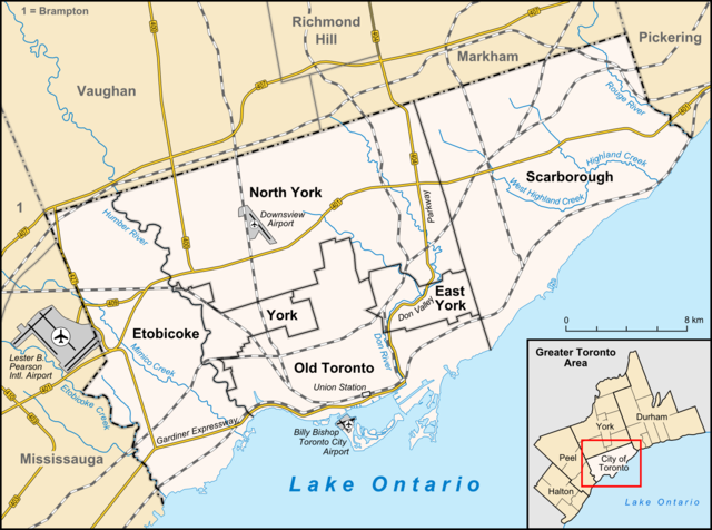
            English: Map of  TorontoGeographic limits of the map: 
             
              - N: 43.8754583°
 
              - S: 43.5655833°
 
              - W: -79.6763555°
 
              - E: -79.0993611°
 
              - ratio of height of image to width = 0.74375


            Français : Carte de  Toronto 
            Deutsch: Karte von  Toronto 
            | 
          
          
           | Date | 
           March 2009 | 
          
          
           | Source | 
           own work, used: 
             - OpenStreetMap
 
             
             - minimap created with  Greater toronto area map-de.svg by  NordNordWest
 
             
            | 
          
          
           | Author | 
            Lencer | 


         This map has been made or improved in the German  Kartenwerkstatt (Map Lab). You can  propose maps to improve as well.


       File usage
       
        The following pages on Schools Wikipedia link to this image (list may be incomplete):


       This file contains additional information, probably added from the digital camera or scanner used to create or digitize it. If the file has been modified from its original state, some details may not fully reflect the modified file.
        
       
      SOS Children's Villages has brought Wikipedia to the classroom. In 133 nations around the world, SOS Childrens Villages works to bring better education and healthcare to families in desperate need of support. Will you help another child today?