
File:2004 Indian Ocean earthquake - affected countries.png
Size of this preview: 586 × 480 pixels.
| |
This is a file from the Wikimedia Commons. Information from its description page there is shown below.
Commons is a freely licensed media file repository. You can help. |
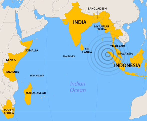
Subject: Map showing countries affected by the 2004 Indian Ocean earthquake.
Source: Created by Cantus using ArcView and Photoshop. Orthographic projection, centered at lat. 0°, long. 80°.
 |
Permission is granted to copy, distribute and/or modify this document under the terms of the GNU Free Documentation License, Version 1.2 or any later version published by the Free Software Foundation; with no Invariant Sections, no Front-Cover Texts, and no Back-Cover Texts. A copy of the license is included in the section entitled GNU Free Documentation License.
|
| This file is licensed under the Creative Commons Attribution-Share Alike 3.0 Unported license. | ||
|
||
| This licensing tag was added to this file as part of the GFDL licensing update.
|
File usage
The following pages on Schools Wikipedia link to this image (list may be incomplete):
Metadata
Find out about Schools Wikipedia
SOS Children's Villages aims to make Wikipedia suitable for young learners. SOS Children is a global charity founded in 1949 to give children who have lost everything the childhood they deserve. There are many ways to help with SOS Childrens Villages.