
File:Lake turkana satellite.jpg
Size of this preview: 640 × 474 pixels.
| |
This is a file from the Wikimedia Commons. Information from its description page there is shown below.
Commons is a freely licensed media file repository. You can help. |
Summary
| Description |
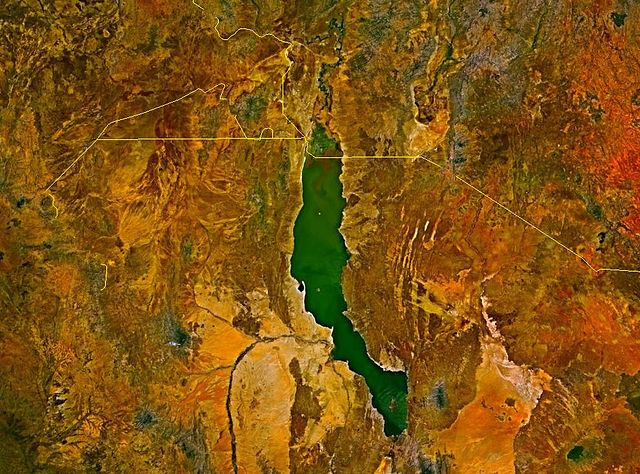
Deutsch: Satellitenbild des Turkana-Sees auf den Staatsgebieten von Kenia und Äthiopien. Die Staatsgrenzen sind als gelbe Linien eingezeichnet. Im Nordwesten befindet sich das sowohl von Äthiopien und Kenia, mindestens bis zur Unabhängigkeit des Südsudan auch vom Sudan, beanspruchte Ilemi-Dreieck.
English: Lake Turkana, Kenya and Ethiopia. satellite image. The yellow lines denote the borders.
|
| Date | |
| Source | |
| Author |
Licensing
 |
This image is in the public domain because it is a screenshot from NASA’s globe software World Wind using a public domain layer, such as Blue Marble, MODIS, Landsat, SRTM, USGS or GLOBE.
|
|
File usage
The following pages on Schools Wikipedia link to this image (list may be incomplete):
What is Schools Wikipedia?
SOS Childrens Villages has brought Wikipedia to the classroom. SOS Children is a global charity founded in 1949 to give children who have lost everything the childhood they deserve. Will you help another child today?