  | 
          
            This is a file from the  Wikimedia Commons. Information from its  description page there is shown below.  Commons is a freely licensed media file repository.  You can help. 
           | 


           | Description | 
           
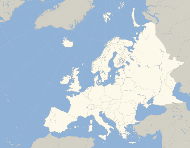
             English: A blank map of Europe. The continental boundary to Asia indicated follows the standard convention of the crest of the Greater Caucasus, the Urals River and the Urals Mountains to the Sea of Kara. 
            | 
          
          
           | Date | 
           2011-04-11 07:04 (UTC) | 
          
          
           | Source | 
           
            
            | 
          
          
           | Author | 


             - derivative work:  Dbachmann ( talk)
 
             
            | 


            | 
          This is a  retouched picture, which means that it has been digitally altered from its original version. Modifications: fixed Caucasus crest. The original can be viewed here:  Blank_map_of_Europe_(polar_stereographic_projection)_cropped.svg. Modifications made by  Dbachmann. 
              
           | 


           I, the copyright holder of this work, hereby publish it under the following licenses:


               | 
             Permission is granted to copy, distribute and/or modify this document under the terms of the  GNU Free Documentation License, Version 1.2 or any later version published by the  Free Software Foundation; with no Invariant Sections, no Front-Cover Texts, and no Back-Cover Texts. A copy of the license is included in the section entitled  GNU Free Documentation License.  http://www.gnu.org/copyleft/fdl.htmlGFDLGNU Free Documentation Licensetruetrue 
              | 


                | 
             The map has been created with the  Generic Mapping Tools:  http://gmt.soest.hawaii.edu/ using one or more of these  public domain datasets for the relief: 
               - ETOPO2 ( topography/ bathymetry):  http://www.ngdc.noaa.gov/mgg/global/global.html
 
               - GLOBE ( topography):  http://www.ngdc.noaa.gov/mgg/topo/gltiles.html
 
               - SRTM ( topography):  http://www2.jpl.nasa.gov/srtm/
 
               
              | 


               | 
             Permission is granted to copy, distribute and/or modify this document under the terms of the  GNU Free Documentation License, Version 1.2 or any later version published by the  Free Software Foundation; with no Invariant Sections, no Front-Cover Texts, and no Back-Cover Texts. A copy of the license is included in the section entitled  GNU Free Documentation License.  http://www.gnu.org/copyleft/fdl.htmlGFDLGNU Free Documentation Licensetruetrue 
              | 
             
            
           You may select the license of your choice.
           | 


       File usage
       
        The following pages on Schools Wikipedia link to this image (list may be incomplete):


       This file contains additional information, probably added from the digital camera or scanner used to create or digitize it. If the file has been modified from its original state, some details may not fully reflect the modified file.
        
       
      Schools Wikipedia was created by children's charity SOS Childrens Villages. SOS Children's Villages cares for children who have lost their parents. Our Children's Villages give these children a new home and a new family, while a high-quality education and the best of medical care ensures they will grow up with all they need to succeed in adult life. Sponsoring a child is the coolest way to help.