
File:Map of Oregon NA.png
Size of this preview: 640 × 433 pixels.
| |
This is a file from the Wikimedia Commons. Information from its description page there is shown below.
Commons is a freely licensed media file repository. You can help. |
| Description |
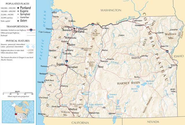
English: Topographic map of the geography of Oregon — with major rivers shown.
|
| Date | |
| Source | National Atlas |
| Author | Unknown |
 |
This map was obtained from an edition of the National Atlas of the United States. Like almost all works of the U.S. federal government, works from the National Atlas are in the public domain. Online access: NationalAtlas.gov | 1970 print edition: Library of Congress, Perry-Castañeda Library
|
 |
File usage
The following pages on Schools Wikipedia link to this image (list may be incomplete):
Want to know more?
Wikipedia for Schools brings Wikipedia into the classroom. SOS Childrens Villages is a global charity founded in 1949 to give children who have lost everything the childhood they deserve. Help another child by taking out a sponsorship.