
File:Indian Ocean bathymetry srtm.png
Size of this preview: 439 × 480 pixels.
| |
This is a file from the Wikimedia Commons. Information from its description page there is shown below.
Commons is a freely licensed media file repository. You can help. |
Summary
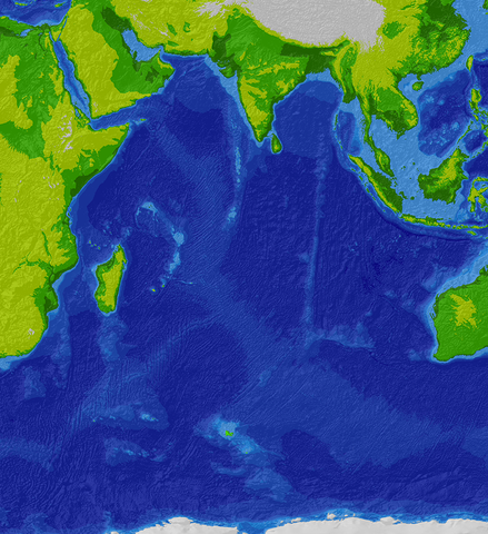
Topographic/bathymetric map of the Indian Ocean region.
Source data: SRTM30_plus 30 arc-second satellite elevation data.
Projection: Winkel I, central median E 80 deg. WGS84 datum.
Projected and hillshaded using ESRI ArcGIS 9.0. Uploaded by the creator.
Licensing
 |
Permission is granted to copy, distribute and/or modify this document under the terms of the GNU Free Documentation License, Version 1.2 or any later version published by the Free Software Foundation; with no Invariant Sections, no Front-Cover Texts, and no Back-Cover Texts. A copy of the license is included in the section entitled GNU Free Documentation License.
|
| This file is licensed under the Creative Commons Attribution-Share Alike 3.0 Unported license. | ||
|
||
| This licensing tag was added to this file as part of the GFDL licensing update.
|
File usage
The following pages on Schools Wikipedia link to this image (list may be incomplete):
Wikipedia for Schools...
Schools Wikipedia was created by children's charity SOS Children. SOS Children believes that a decent childhood is essential to a happy, healthy. Our community work brings families new opportunities through education, healthcare and all manner of support. Would you like to sponsor a child?