
File:Chad sat.jpg
Size of this preview: 315 × 479 pixels.
| |
This is a file from the Wikimedia Commons. Information from its description page there is shown below.
Commons is a freely licensed media file repository. You can help. |
| Description |
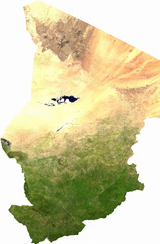
Español: Mapa satelital de Chad, se puede apreciar el contraste entre la zona árida del norte, que corresponde al sur del Sahara; y la zona fértil del sur. Los musulmanes del norte piden privilegios económicos.
English: ECW to TIFF to JPEG (100% quality; progressive formatting).
|
| Date | 13 July 2006 |
| Source | user |
| Author | Cwolfsheep |
Licensing
 |
This file is in the public domain, because it was generated by a user, using free sources available at The Map Library. Note that this does not include the maps in the Global Administrative Areas section of the homepage. |
File usage
The following pages on Schools Wikipedia link to this image (list may be incomplete):
More information
Wikipedia for Schools is designed to make learning fun and easy. SOS Children's Villages believes education is an important part of a child's life. That's why we ensure they receive nursery care as well as high-quality primary and secondary education. When they leave school, we support the children in our care as they progress to vocational training or higher education. Why not try to learn more about child sponsorship?