
File:800px-tropical wet forests.png
| |
This is a file from the Wikimedia Commons. Information from its description page there is shown below.
Commons is a freely licensed media file repository. You can help. |
 |
This Map image could be recreated using vector graphics as an SVG file. This has several advantages; see Commons:Media for cleanup for more information. If an SVG form of this image is already available, please upload it. After uploading an SVG, replace this template with {{ vector version available|new image name.svg}}. |
Summary
Licensing
 |
I, the copyright holder of this work, release this work into the public domain. This applies worldwide. In some countries this may not be legally possible; if so: I grant anyone the right to use this work for any purpose, without any conditions, unless such conditions are required by law.
|
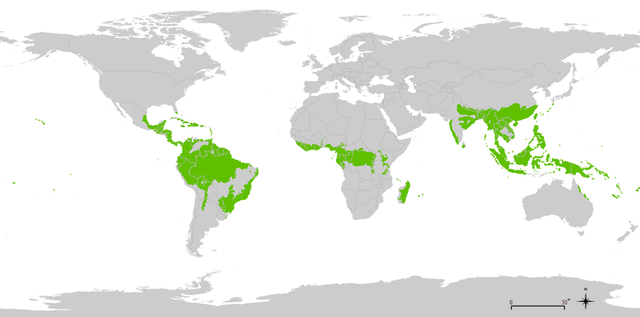
Using the following source : "Biome boundary. The humid tropical biome was delineated using the World Wildlife Fund terrestrial ecoregions map. This map was modified to exclude mountain and coastal forest mosaic ecoregions in Africa." on Global Forest Monitoring Project
Original data licensed as : "Provided data are available for use for valid scientific, conservation, and educational purposes as long as proper citations are used. We ask that you credit the Humid Tropical Monitoring data as follows: Hansen, M.C., Stehman, S.V., Potapov, P.V., Loveland, T.R., Townshend, J.R.G., DeFries, R.S., Pittman, K.W., Stolle, F., Steininger, M.K., Carroll, M., Dimiceli, C. (2008) Humid tropical forest clearing from 2000 to 2005 quantified using multi-temporal and multi-resolution remotely sensed data. PNAS, 105(27), 9439-9444."
Shapefile : htropbiome.zip ; World background from "Country Area (2010-11-01) Filename: cnty_area" from UNEP.
File usage
Metadata
Find out about Schools Wikipedia
Learning is fun and easy with Schools Wikipedia. SOS Children is an international children's charity, providing a good home and loving family to thousands of children who have lost their parents. We also work with communities to help vulnerable families stay together and raise children in the best possible environment. Help another child by taking out a sponsorship.